Know which street is flooded before you ride in.
Né Ngập shows nearby flood hot spots, water depth on a motorbike scale, and whether water is rising or receding — reported by riders on the road and updated in seconds.
Version 1.0.0 is preparing for closed testing on iOS & Android. Free, ad-free, no account required.
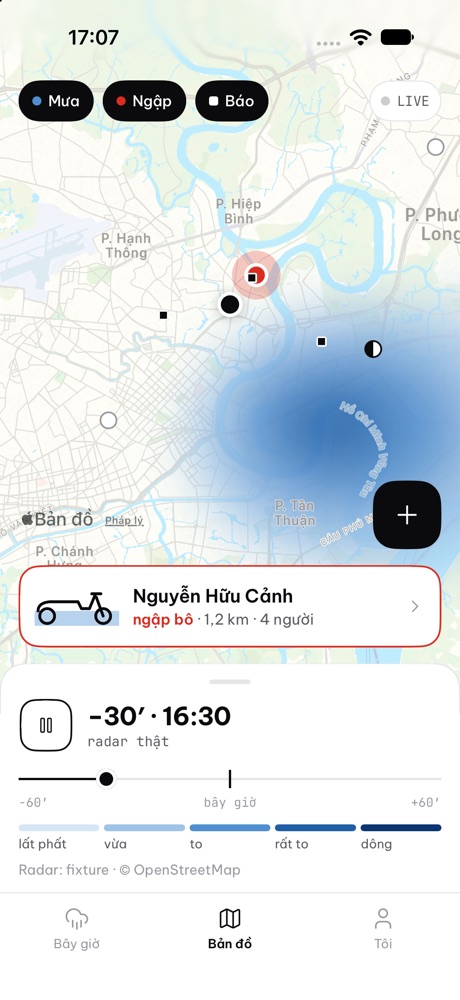
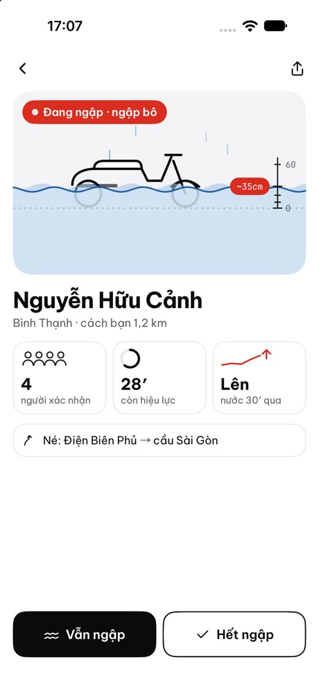
Everything about street flooding, on one screen.
No cluttered tables, no long paragraphs. One glance tells you whether to take that road.
Live flood spots
54 known flood hot spots across Ho Chi Minh City and Hanoi, updating live when riders report. Water depth is drawn on a scooter scale: ankle, half wheel, exhaust, seat.
Report in 2 taps
Standing in front of flooded water? Tap “Flooding”, pick the depth, send. Anonymous, expires in 45 minutes (extended up to 3 hours as riders confirm “Still flooded / Gone”).
High tides
Upcoming estimated tide peak time and height in Ho Chi Minh City — why streets like Nguyễn Hữu Cảnh, District 7, and Nhà Bè can flood even on dry afternoons.
Map & detour hints
Live map of flood hot spots and rider reports, with practical detour notes per location so you can turn early.
Home & lock screen widgets
Glance at nearby flood status on iPhone and Android without opening the app.
Minute rain & A→B trips soon
Minute-range rain forecasts and on-device route rain checks. Currently completing commercial data licensing before public activation.
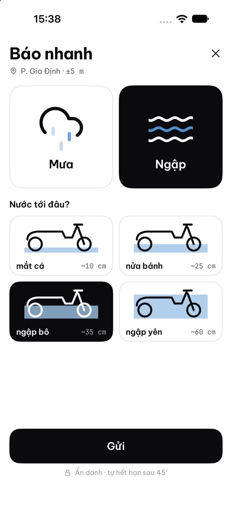
Riders reporting for riders.
Fixed sensors only cover a few spots. Riders already on the street see where water actually blocks traffic first.
- 1Spot a flooded stretchOpen the app and tap “Report”. Your position is rounded to ≈ 11 m only when you submit; offline reports queue automatically.
- 2Pick how deep the water isFour visual levels against a motorbike — no guessing centimetres, no typing required.
- 3Visible to nearby riders in secondsThe spot updates to “Flooding” with trend status, and riders nearby can confirm “Still flooded” or “Gone”.
Two cities, one clear view.
Outside Ho Chi Minh City or Hanoi? You can still browse either city directly from the app.
Ho Chi Minh City
- 27 rain & tide flood hot spots
- Estimated high-tide peak schedule
- Live community flood reports & votes
Hanoi
- 27 known flood spots: Nguyễn Khuyến, Phan Bội Châu, Tố Hữu…
- Local detour hints per flood point
- Live community flood reports & votes
Privacy by design.
No accounts, no ads, no behavioural tracking SDKs, no sale of personal data.
Important notice: Né Ngập is not an official disaster warning (“Né Ngập không phải cảnh báo thiên tai chính thức”). Forecasts and tide levels are estimates for reference only, and community reports are user-submitted. Always follow official authority guidance and never use the phone while riding.